- Home Home
-
Residents
Residents
- Waste & recycling Bins, clean-ups and disposing of tricky household items
- Parking Permits, car parks, maps and safety
- Your trees, plants & garden Tree pruning, native gardens and Living Connections
- Neighbourhood issues Report and resolve common issues
- Pets Dog and cat ownership, lost animals and off-leash parks
- Precinct committees Your local connection to Council
- Waverley LGA Maps Maps of the environment, planning zones and more
- Payments Pay for rates, certificates, permits and licences
-
Community
Community
- Children, youth & family services Early education, day care, support & resources
- Awards & grants Local Hero Awards, Garden Awards, Small Grants
- Get involved in your community Volunteering, creating connections, gardening
- Over 60s Services, activities, Mill Hill 60+ program
- Housing & homelessness Affordable housing, programs & support services
- Cultural diversity & inclusion Multiculturalism, language help, citizenship
- Aboriginal & Torres Strait Islander people Commitment to Reconciliation, plans & policies
- Disability inclusion Support services, access & inclusion projects
-
Business
Business
- Resources for Business Events, grants and support
- Innovation Roadmap 2025 to support business
- Tourism Home to Australia's most famous beach.
- Sponsorship Support local events
- Procurement Submitting tenders & expressions of interest to Council
- Commercial waste & recycling services Tailored waste services for business
- Mobile vending Waverley has limited mobile vending licenses
- Hello Bondi Council’s website to help visitors enjoy their stay
-
Recreation
Recreation
- Events Browse performances, exhibits and experiences
- Places of interest Historic buildings, markets, dining and Bondi Pavilion
- School Holiday Programs Fun-filled activities, workshops and events.
- Beaches & coast Beach information, safety, pool cleaning schedules
- Parks & reserves Location, public facilities and accessibility
- Arts & culture Artistic vision, creative programs, spaces and awards
- Venue & sport facilities hire Book indoor venues and sport facilities in Waverley
- Use of public spaces Events, commercial activations, filming etc
-
Environment
Environment
- Council leadership on environmental action Research, strategies and Council programs
- Climate resilience and reducing emissions Switch to electric, go solar and grants for apartments
- Water and the coast Keep beaches clean, save water and enjoy the sea
- Towards zero waste Reduce waste at home and at work
- Public tree management & urban greening Street Tree Masterplan and planting zones
- Native vegetation and animal habitat Join Bushcare and enjoy Waverley’s natural spaces
- Transport Council policy, bike and car share, electric vehicles
- Second Nature Council’s environmental news and events hub
-
Planning & Development
Planning & Development
- Development Applications The DA process, key documents & community consultation
- DA Tracking Tool Search a Development Application by number or date
- Application forms & certificates incl Planning, Rating, Construction and Occupation
- Waverley Local Planning Panel (WLPP) DA determination panel
- Compliance and regulations incl fire safety, food, pools and pollution
- Heritage incl Heritage Conservation Areas and fact sheets
- Urban planning and design Making Waverley a great place to live and work
- Major projects Council-delivered buildings, streets and parks
-
Council
Council
- Organisation structure Four directorates serve the community
- Mayor & councillors Your Mayor, Councillors, wards and contact details
- Council & committee meetings Dates, agendas and minutes of meetings of Council
- Advisory committees Advisory Committees of Council
- Policies, plans, strategies and reports Council's vision and delivery
- Jobs Current vacancies and working at Waverley
- Access to information Gaining access to publicly available information
- Payments Pay for rates, certificates, permits and licences
- Home
- >
- Environment
- >
- Water and the coast
- >
- Waverley's marine diversity
- Council leadership on environmental action
- Climate resilience and reducing emissions
- Water and the coast
- Towards zero waste
- Public tree management & urban greening
- Native vegetation and animal habitat
- Transport
- Second Nature
Waverley's marine diversity
Waverley’s waters provide habitat to abundant marine life, from microscopic organisms to giant humpback whales. But human activities can impact water quality and threaten the marine environment, through urban development, litter and pollution. Major storm events and sea levels are projected to increase, with climate change also threatening the fragile ecosystems under the waves. Get involved in marine protection activities and educational events - visit Second Nature.
Beaches
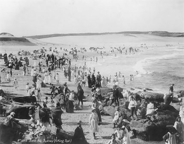
Occupying 1.4km of coastline, Waverley's beaches have undergone enormous transformation over decades of urban development and population growth. Millions of local and international visitors visit our beaches each year which also puts pressure on the local environment.
Our beaches are now without any sand dunes and the biodiversity that would have once been present. Despite this, Waverley’s beaches are still teeming with life under the sand.

Rockpools and intertidal rocky shores
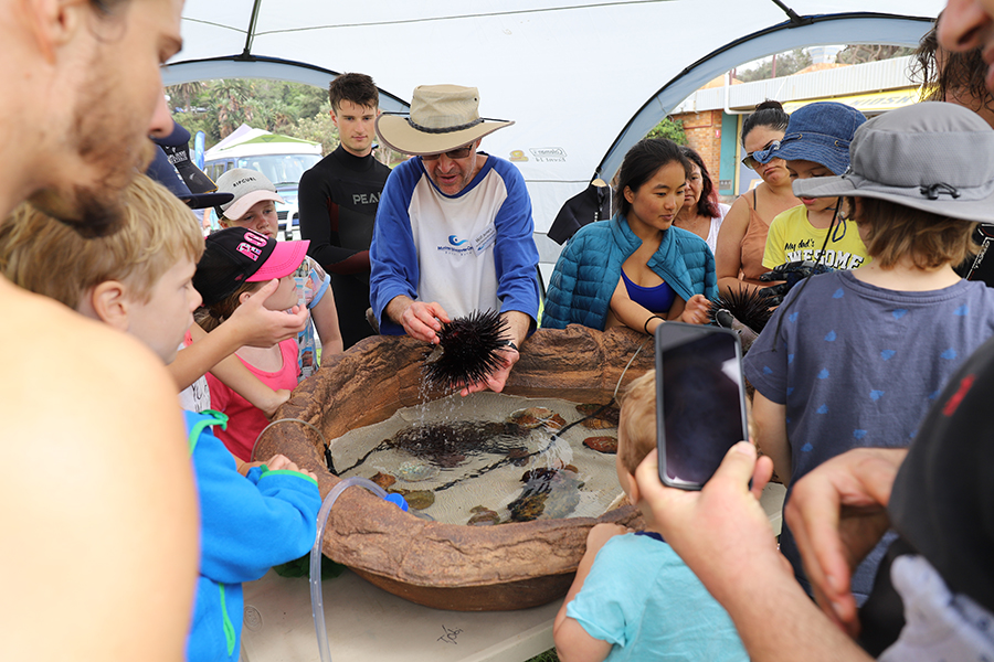
These include rockpools, crevices, platforms, boulders and cobbles (i.e. “smaller boulders”), which are home to a diverse range of creatures.
These include:
- herbivorous snails e.g. turban snails, limpets, periwinkles
- predatory whelks e.g. mulberry whelk, triton snail and cone shells; chitons, nudibranchs and sea slugs
- cephalopods e.g. gloomy octopus
- crabs and barnacles
- sea stars and urchins
- marine worms and centipedes
- vertebrate species such as toadfish
- green, red and brown algae
Rocky shores also provide a vital environment for many marine birds for feeding, nesting and as nursery grounds. Increasing urban development and human population growth on the coastal fringes of the Eastern Suburbs has impacted on these local environments through:
- increased nutrient loading from stormwater
- contaminated run-off
- pollution
- trampling (especially due to the high volume of visitors to Waverley’s coastal environments)
- vandalism
- exploitation or harvesting of intertidal species from the rock platform (e.g. use of cunjevoi as bait)
- climate change and sea level rise
Protection and conservation of intertidal areas
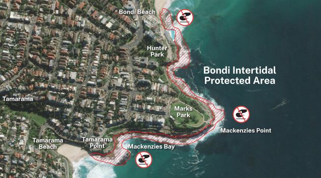
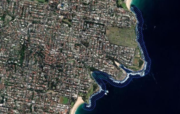
Intertidal Protected Areas (IPAs) are used as a conservation tool to provide protection to selected rocky shore habitats and their species.
Removing animals and invertebrates from these areas is totally prohibited. This includes the removal of crabs, snails, worms, cunjevoi, octopus, sea urchins, anemones, pipis, cockles, mussels, oysters and saltwater pink nippers (yabbies). Intertidal protected areas extend from the mean high-water mark to 10 metres below mean low water.

Bondi Intertidal Protected Area, image credit: DPI Fisheries
Rocky reefs
These are sub-tidal regions that lie below the low water mark. Because they are underwater, these marine environments are not as heavily impacted by extreme environmental fluctuations as intertidal rocky shores are.
As a result, they provide a stable environment that can support more complex and diverse marine life.
This includes:
- Larger brown algae such as kelp – Ecklonia radiata and Strap weed – Phyllospora comosa
- A range of red, green and brown algae
- Waverley’s majestic Weedy Seadragon – Phyllopteryx taeniolatus
- Ornate Wobbegong – Orectobulus ornatus
- Seagrass such as of Paddleweed – Halophila sp. and eel grass or seawrack (Zostera sp.)
- Smaller species such as pipefish, seahorses, wandering anemones and tube worms
- Gastropod snails such as the Tent Shell – Australium tentoriiforme and Variegated Limpet – Cellana tramoserica
- Crustacean species of barnacles such as the Giant rock barnacle – Balanus nigrescens, subtidal ascidian species such as Sea Tulips – Pyura gibbosa or Pyura spinifera and a mix of different sponges
- Common sea urchin – Centrostephanus rodgersii
- The local and iconic Blue groper – Achoerodus viridus
Bronte-Coogee Aquatic Reserve
The Bronte-Coogee Aquatic Reserve (BCAR) stretches from the southern end of Bronte Beach to the northern end of Coogee Beach. Since March 2002, it has protected a diversity of rocky shore habitats and extends out 100 metres from the shoreline to further provide protection offshore.
Managed by National Parks NSW, the reserve covers a total area of 42 hectares and restricts what activities can be carried out within its boundaries. In addition, the Bronte-Coogee Aquatic Reserve has been the focus of scientific research involving a suite of research institutions and support from Waverley Council and Randwick City Council, such as the blue groper tagging study.


Find out more about the Bondi Coogee Aquatic Reserve.


